BIM and GIS: Get the Best of Both

Getting the most out of BIM and GIS is essential in maximizing project potential. Missing out on important information or misusing the tools can lead to poor project performance and lower-quality output. Angel Espinoza, Senior Technical Sales Specialist at Autodesk, discusses what GIS and BIM collaboration can do for your workflow, as well as productivity gains. What exactly are these tools and how do they relate to one another?
What is BIM?
Simply stated, BIM stands for Building Information Modeling. This process begins with developing a 3D design model used throughout the project lifecycle and has vastly improved how buildings and infrastructure are created from the days of building projects.
What is GIS?
GIS stands for Geographic Information System. The software used for GIS provides a basis for collecting and reviewing data as well as helps understand the physical world in which a building or infrastructure stands.
How do they relate to one another?
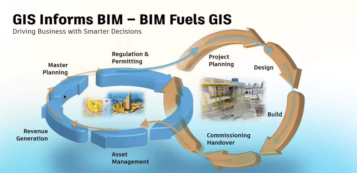
As Angel states, GIS informs BIM, and BIM fuels GIS in return. While GIS is providing the context of the area in which a building exists, building information is sharing data that allows for better planning for future projects. Instead of the relationship being finite, it represents a more cyclical connection that improves as the process continues.
Watch the full presentation discussing the keys to collaboration here.